Back to Weather

5-day forecast / Sherman, TX

TodayShowers And Thunderstorms82° / 67° 76%
MondayChance Showers And Thunderstorms79° / 66° 36%
TuesdayMostly Sunny86° / 72° 3%
WednesdayMostly Sunny92° / 77° 2%
ThursdayMostly Sunny92° / 72° 4%

Flood Advisory in Effect for Sherman as Heavy Rain and Fog Persist

Sherman skies, every four hours — clear, local, and weather you can trust.

A minor Flood Advisory is active for Sherman, TX, as heavy rain and fog create hazardous conditions. Temperatures are near 67F with high winds. Expect showers and thunderstorms today and tomorrow.

Carmen Solis

June 14, 20262 min read

National Weather Service radar for North Texas (KFWS)

Active Alert and Current Conditions

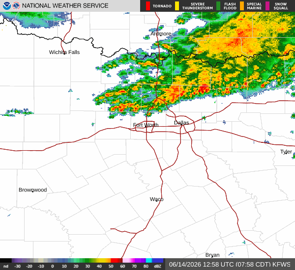
A minor Flood Advisory is currently in effect for Sherman, Texas. This alert was issued by the National Weather Service in Fort Worth and remains active until 9:15 AM CDT today. Residents should remain vigilant as the advisory indicates potential for flooding due to the ongoing weather patterns.

Right now, the atmosphere is heavy with rain and fog or mist, significantly reducing visibility. The air temperature is sitting at 67F, with a feels-like temperature of 67F. Humidity is extremely high at 98%, with a dew point of 66F. Winds are blowing from the east at 14 mph, with gusts reaching up to 24 mph. These conditions contribute to the slick and potentially dangerous travel environment.

Forecast for Today and Tomorrow

Today, there is a high chance of precipitation at 88%, with showers and thunderstorms expected. The National Weather Service details that a chance of showers and thunderstorms is likely before 7 AM, followed by more active showers and thunderstorms between 7 AM and 10 AM. After that, a chance of showers and thunderstorms will persist. The sky will eventually become partly sunny. The high will reach near 80F, though temperatures may fall to around 77F in the afternoon. Winds will shift to the east at 5 to 10 mph. There is a possibility of new rainfall amounts between a quarter and half of an inch.

Tonight, the chance of precipitation drops to 50%, with a chance of showers and thunderstorms. The sky will be mostly cloudy, with a low around 67F. Winds will come from the north northeast at 5 to 10 mph. New rainfall amounts between a tenth and a quarter of an inch are possible.

Tomorrow, the pattern continues with a chance of showers and thunderstorms before 7 AM, then again between 7 AM and 10 AM. The sky will be partly sunny, with a high near 78F. Winds will be from the northeast at 5 to 10 mph. The chance of precipitation is 50%, with new rainfall amounts less than a tenth of an inch possible. Tomorrow night will be mostly cloudy with a low around 66F.

Safety Reminder

Given the active Flood Advisory and heavy rain, please exercise caution. Avoid driving through flooded roadways and stay informed about local conditions. Hydrate regularly as temperatures rise, and check on neighbors who may need assistance during these wet conditions.

National Weather Service radar for North Texas (KFWS)

Sources

https://radar.weather.gov

https://api.weather.gov

https://open-meteo.com

Share

Carmen Solis

Carmen Solis covers weather, the environment, and outdoor life around Sherman.

Related Stories

Weather

Humid Start to Sunday in Sherman with Rain Likely

Sherman residents face high humidity and a strong chance of showers and thunderstorms today. Temperatures will hover near 80F with significant moisture in the air.

Carmen SolisJune 14, 20262 min read
Weather

Humid Start to Sunday Night for Sherman as Storms Linger

Sherman residents face high humidity with a dew point of 73F tonight. Scattered showers and thunderstorms are expected through Sunday, with a slight cooldown and lingering chance of rain tomorrow.

Carmen SolisJune 14, 20262 min read